
Earth'sHidden Layers
Explore geological formations, track seismic activity, and discover mineral resources with interactive 3D terrain models and advanced earth science analytics.
Get Started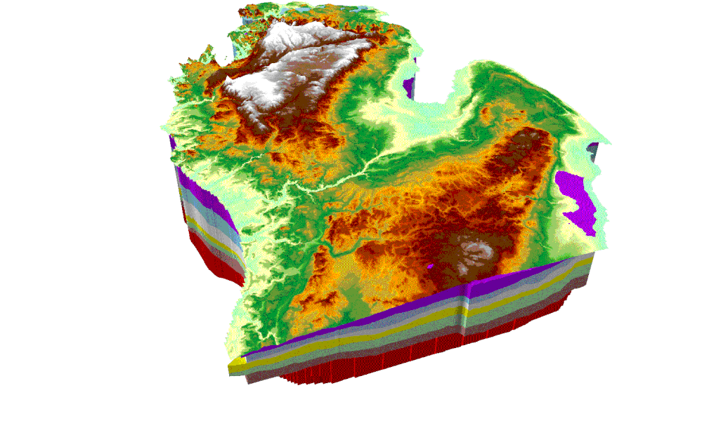
3D Geological Model
Interactive terrain analysis
Earth Science Analytics
Seismic Event Map
Live global earthquake monitoring with magnitude filters, depth analysis, and predictive risk assessment.
Geological Timeline
Interactive slider to explore rock formation changes over millennia with stratigraphic analysis.
Resource Finder
Cross-reference geological surveys with economic data to identify potential mineral and resource deposits.
Regional Analysis Tool
Draw a polygon on any region to get comprehensive geological assessment including resource potential and seismic risk.
Resource Mapping
Identify potential mineral deposits and geological formations with high economic value.
Seismic Risk Analysis
Evaluate earthquake probability and fault line proximity for safety assessments.
Terrain Accessibility
Assess infrastructure access and logistical feasibility for exploration projects.
Geological Layers
Geological Analytics FAQs
Making Sense of Complex Earth Science Data
Geological research draws on an unusually varied mix of data: seismic monitoring feeds, stratigraphic survey records, terrain models, and resource assessments that are often maintained in separate specialist systems. Mimasa AI's Data Intelligence Stack was designed to unify exactly this kind of technical, multi-format data, using 180+ connectors to bring seismic activity, mapping data, and survey records into a single governed workspace for geologists and earth scientists.
With that data connected, Mimasa AI's conversational analytics layer lets analysts ask direct questions about seismic risk, formation age, or resource potential in a given region and receive maps, timelines, and comparisons in return, rather than switching between separate GIS and statistical tools. Because Mimasa AI is LLM-agnostic, it can route deeper geological reasoning tasks to the most capable available model while handling routine queries more efficiently, keeping analysis responsive even for large survey datasets.
For teams monitoring active seismic zones or ongoing exploration projects, Mimasa AI's agentic automation can watch live feeds and trigger alerts or workflow updates automatically when defined thresholds are crossed, reducing reliance on manual monitoring. Combined with role-based access control and support for on-prem, VPC, or cloud deployment, this gives research institutions and exploration teams a secure, governed home for sensitive survey and resource data.
Explore Earth's Mysteries
Join geologists and earth scientists using advanced analytics for geological research and exploration.